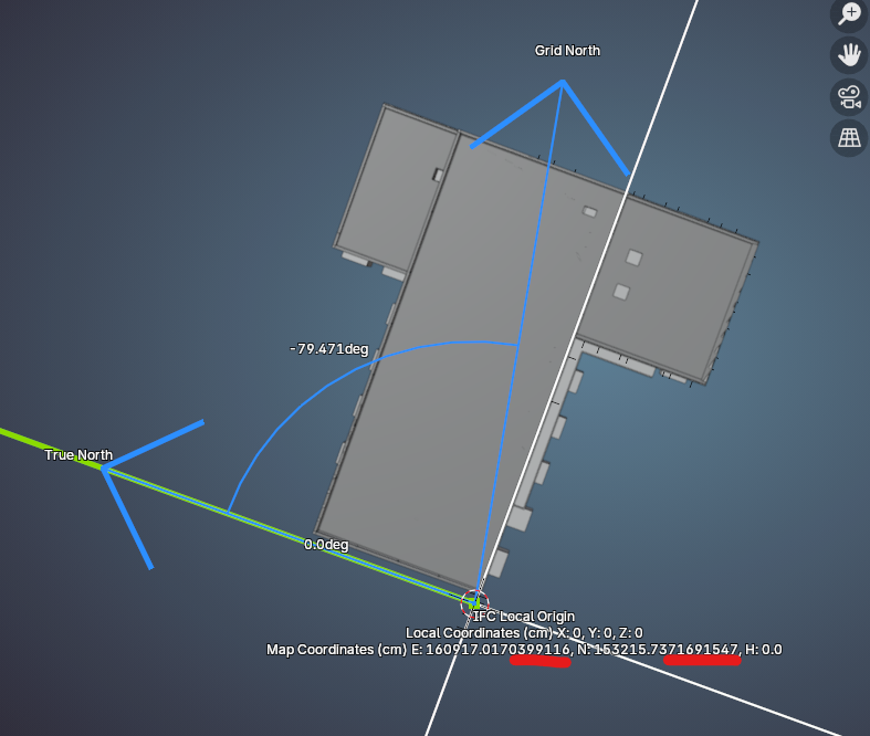
More accurency here than mm. (3 decimals) is not wanted /confusing.
And maybe ESPG code to display as well.
If there a better place to issue this than here on the forum, please show me where.
More accurency here than mm. (3 decimals) is not wanted /confusing.
And maybe ESPG code to display as well.
If there a better place to issue this than here on the forum, please show me where.
hi @magicalcloud_75
More accurency here than mm. (3 decimals) is not wanted /confusing.
And maybe ESPG code to display as well.
If there a better place to issue this than here on the forum, please show me where.
you can post an issue here
BTW the reason I showed more numbers there is because although mm is really more than enough for surveying, computers compare using a different precision. Some federation software will error out saying the coords arent the same.
But yeah let's be more sensible.
Ok. I can get this perspective allthough i have a other opinion about these meaning are practical use for this metadata.. But If you look at the units, it says 'cm' which is not correct. It should say 'm' , even if the is 'cm' based IFC model. I think values used for geo-location should always be m. with 3 digits precise (mm. precise). That's my personal take. Maybe there are some guidelines?
@magicalcloud_75
Ok. I can get this perspective allthough i have a other opinion about these meaning are practical use for this metadata.. But If you look at the units, it says 'cm' which is not correct. It should say 'm' , even if the is 'cm' based IFC model. I think values used for geo-location should always be m. with 3 digits precise (mm. precise). That's my personal take. Maybe there are some guidelines?
to the best of my knowledge unit depends on the projection system used (CRS or EPSG), here in Ghana we use feet or meters when using UTM
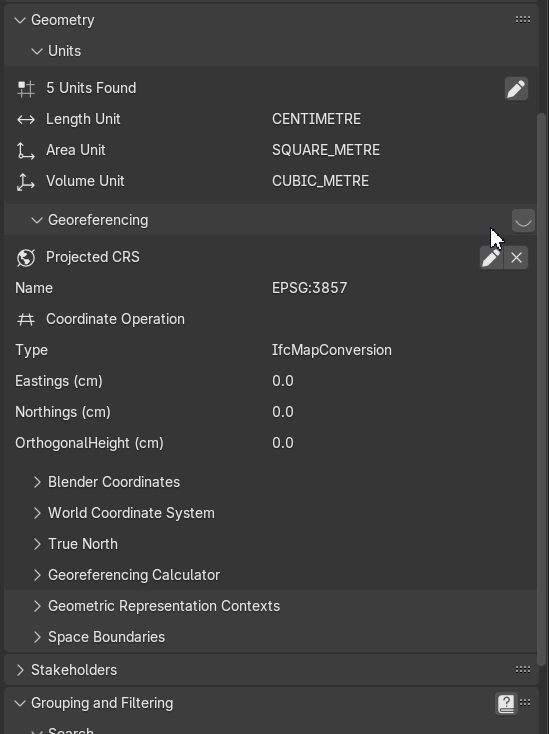
I kind of agree with you that cm might not be correct, I think you can change it in Geometry > Units as shown in the clip below
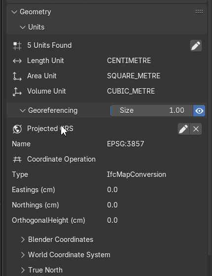
The unit shown for your local coordinates are based on your project units. The unit shown for your map coordinates are based on your map units. If map units are not specified, then it defaults to the same as your project units.
thanks @Moult
yep, forgot to show that important detail, to have "metre" available in the Map Unit box you need to add it first as Length:
I hope this is correct
EDIT
you don't need to set metre clicking on the white dot, which sets the unit of your model, when you add metre the menu in the panel below to set map unit shows that option anyway..
Login or Register to reply.