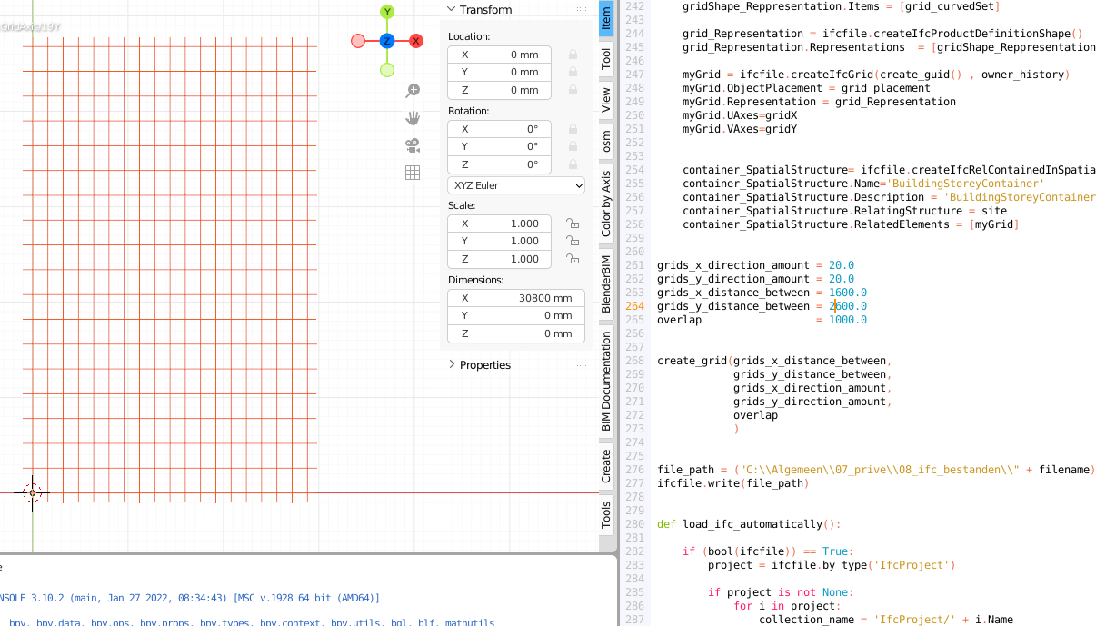
After reading this thread and seeing this post on a Freecad forum from 2016.
It made me wonder if I could create an .ifc with Python starting from the basics with a grid.
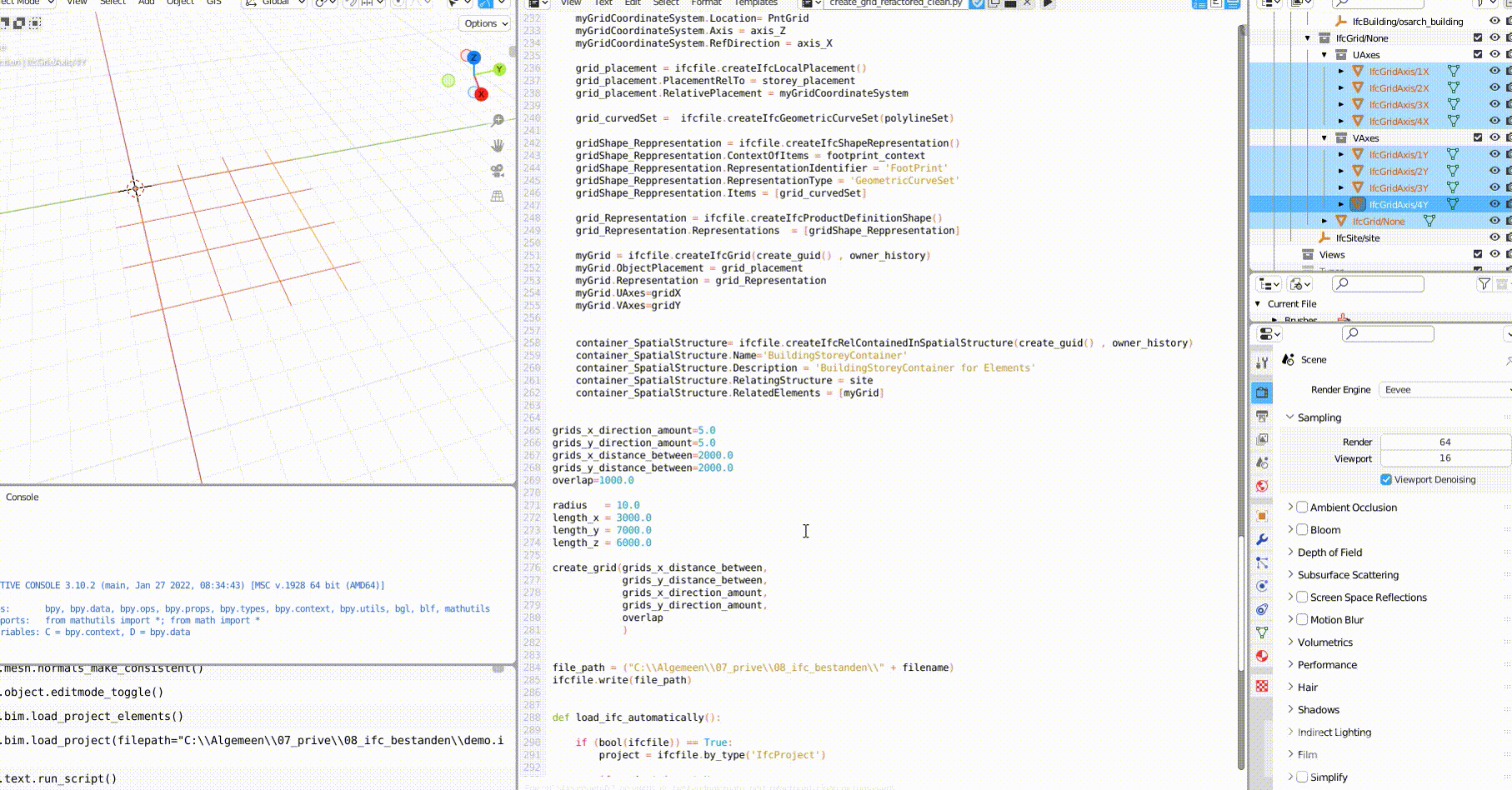
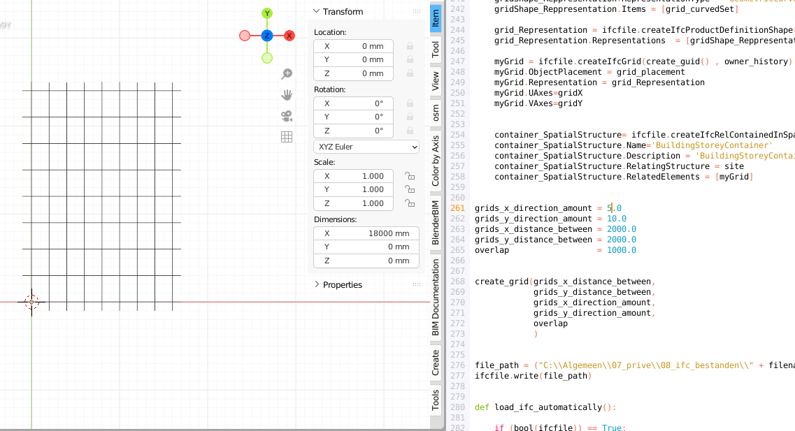
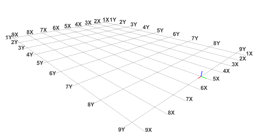
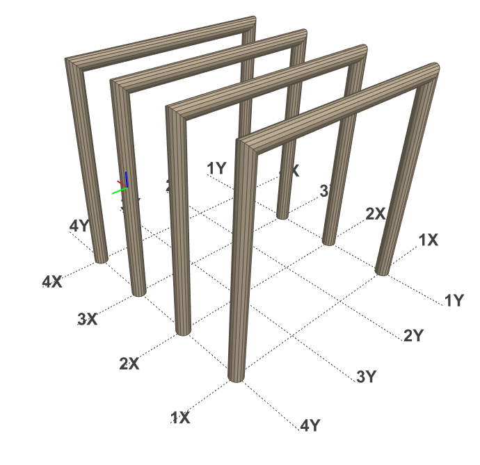
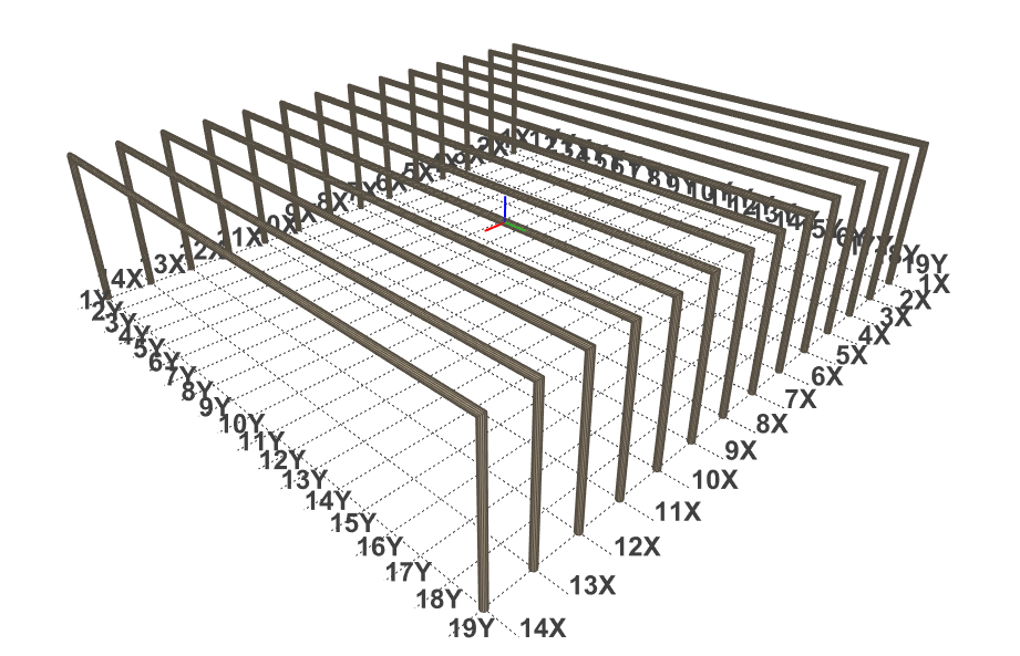
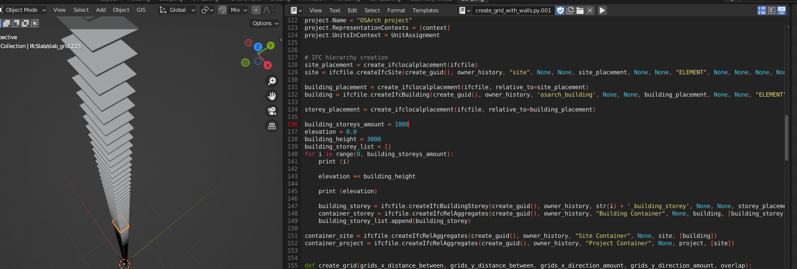
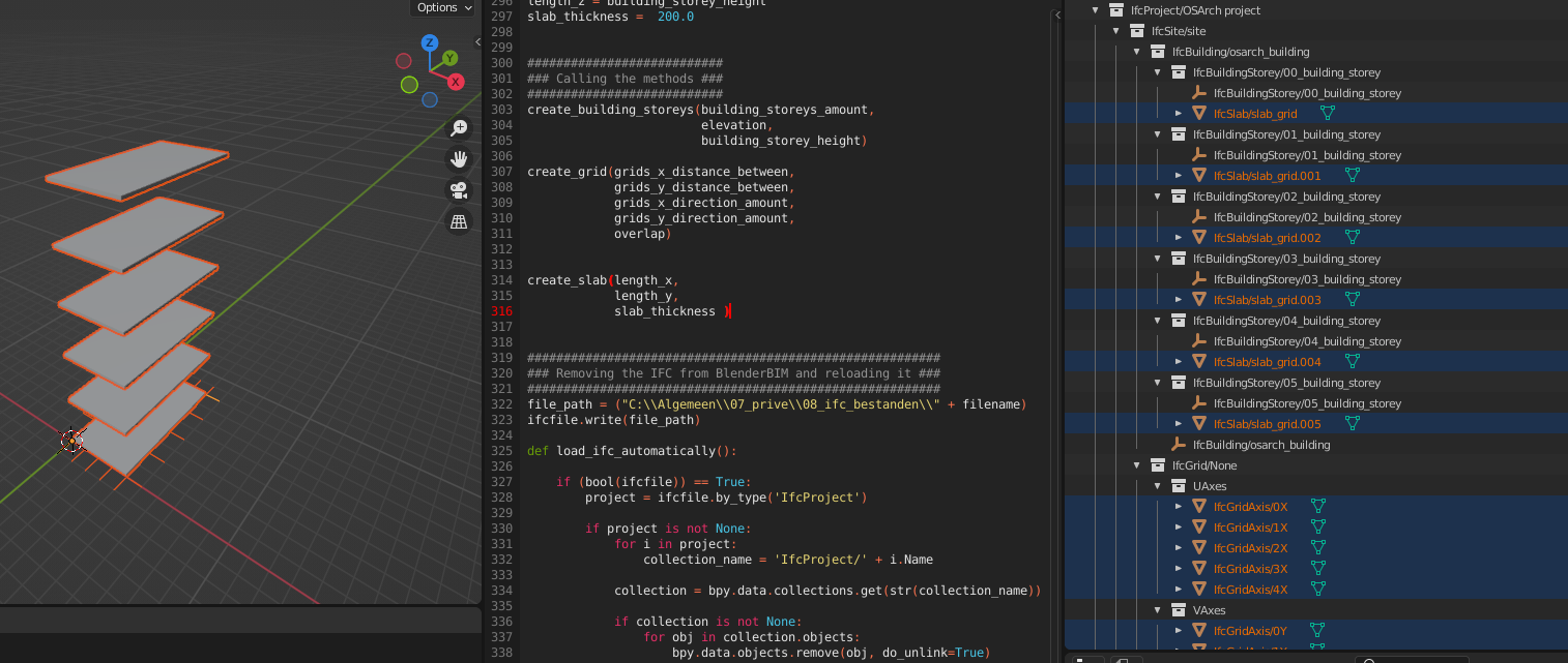
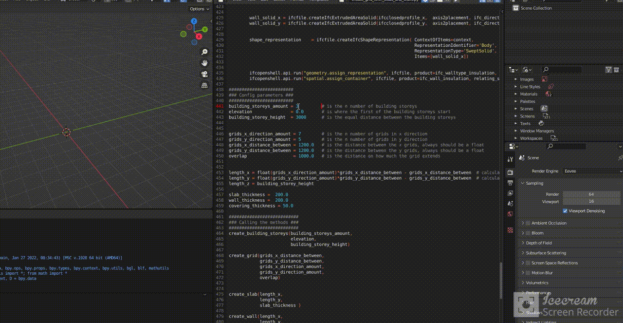
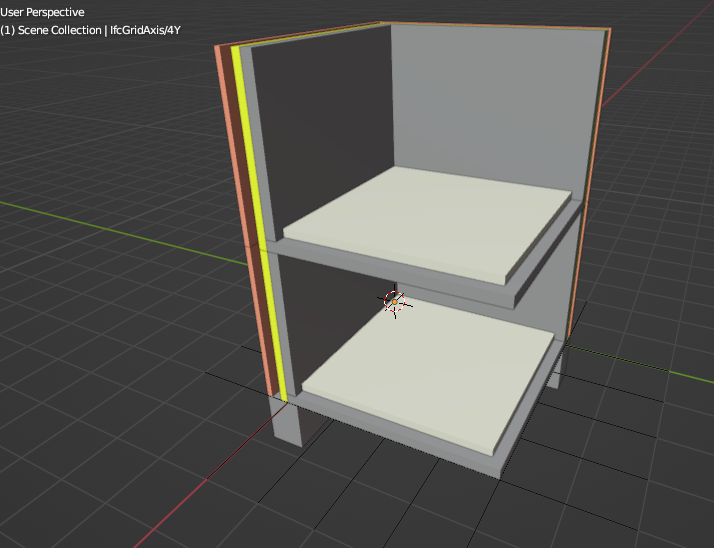
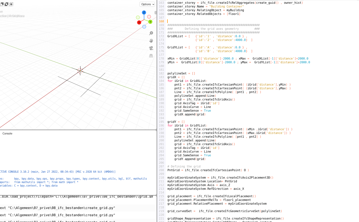
Conclusion, it seems I can, I barely changed the script and loaded the .ifc in BlenderBIM
Here is the python code:
<details>
<summary>See the python code</summary>
import os
import sys
import time
import uuid
import math
import ifcopenshell
O = 0., 0., 0.
X = 1., 0., 0.
Y = 0., 1., 0.
Z = 0., 0., 1.
create_guid = lambda: ifcopenshell.guid.compress(uuid.uuid1().hex)
file_name = 'grid.ifc'
timestamp = time.time()
timestring = time.strftime("%Y-%m-%dT%H:%M:%S", time.gmtime(timestamp))
creator = "C. Claus"
organization = "Claus aannemingsmaatschappij"
application, application_version = "IfcOpenShell", "0.5"
project_globalid, project_name = create_guid(), "Grid"
# open for Blank
ifc_file = ifcopenshell.file()
#=============================================
org = ifc_file.createIfcOrganization()
org.Name = organization
app = ifc_file.createIfcApplication()
app.ApplicationDeveloper = org
app.Version = "3.2"
app.ApplicationFullName = "BlenderBIM"
person = ifc_file.createIfcPerson()
person.FamilyName="C. Claus"
person_org= ifc_file.createIfcPersonAndOrganization()
person_org.ThePerson=person
person_org.TheOrganization=org
owner_hist= ifc_file.createIfcOwnerHistory()
owner_hist.OwningUser = person_org
owner_hist.OwningApplication = app
owner_hist.ChangeAction= "NOCHANGE"
owner_hist.CreationDate= int(time.time())
# Global unit definitions
LengthUnit = ifc_file.createIfcSIUnit()
LengthUnit.UnitType = "LENGTHUNIT"
LengthUnit.Prefix = "MILLI"
LengthUnit.Name="METRE"
#AreaUnit = ifc_file.createIfcSIUnit("AREAUNIT" , None, "SQUARE_METRE")
AreaUnit = ifc_file.createIfcSIUnit()
AreaUnit.UnitType = "AREAUNIT"
AreaUnit.Name="SQUARE_METRE"
VolumeUnit = ifc_file.createIfcSIUnit()
VolumeUnit.UnitType = "VOLUMEUNIT"
VolumeUnit.Name="CUBIC_METRE"
PlaneAngleUnit = ifc_file.createIfcSIUnit()
PlaneAngleUnit.UnitType = "PLANEANGLEUNIT"
PlaneAngleUnit.Name ="RADIAN"
AngleUnit = ifc_file.createIfcMeasureWithUnit()
AngleUnit.UnitComponent =PlaneAngleUnit
AngleUnit.ValueComponent = ifc_file.createIfcPlaneAngleMeasure(math.pi/180)
DimExp = ifc_file.createIfcDimensionalExponents(0,0,0,0,0,0,0)
ConvertBaseUnit = ifc_file.createIfcConversionBasedUnit()
ConvertBaseUnit.Dimensions = DimExp
ConvertBaseUnit.UnitType="PLANEANGLEUNIT"
ConvertBaseUnit.Name="DEGREE"
ConvertBaseUnit.ConversionFactor = AngleUnit
UnitAssignment=ifc_file.createIfcUnitAssignment([LengthUnit , AreaUnit , VolumeUnit ,ConvertBaseUnit])
axis_X = ifc_file.createIfcDirection(X)
axis_Y = ifc_file.createIfcDirection(Y)
axis_Z = ifc_file.createIfcDirection(Z)
Pnt_O = ifc_file.createIfcCartesianPoint(O)
# Defining project and representation contexts
WorldCoordinateSystem = ifc_file.createIfcAxis2Placement3D()
WorldCoordinateSystem.Location=Pnt_O
WorldCoordinateSystem.Axis = axis_Z
WorldCoordinateSystem.RefDirection = axis_X
context = ifc_file.createIfcGeometricRepresentationContext()
context.ContextType = "Model"
context.CoordinateSpaceDimension = 3
context.Precision = 1.e-05
context.WorldCoordinateSystem = WorldCoordinateSystem
footprint_context = ifc_file.createIfcGeometricRepresentationSubContext()
footprint_context.ContextIdentifier = 'FootPrint'
footprint_context.ContextType = "Model"
footprint_context.ParentContext = context
footprint_context.TargetView = 'MODEL_VIEW'
myProject = ifc_file.createIfcProject(create_guid())
myProject.OwnerHistory = owner_hist
myProject.Name = "Test Grid"
myProject.RepresentationContexts = [context]
myProject.UnitsInContext = UnitAssignment
# Defining site, building and first story ------------
site_placement = ifc_file.createIfcLocalPlacement()
site_placement.RelativePlacement=WorldCoordinateSystem
mySite = ifc_file.createIfcSite( create_guid() )
mySite.OwnerHistory = owner_hist
mySite.Name = "My Site"
mySite.ObjectPlacement = site_placement
mySite.CompositionType="ELEMENT"
building_placement = ifc_file.createIfcLocalPlacement()
building_placement.PlacementRelTo = site_placement
building_placement.RelativePlacement = WorldCoordinateSystem
myBuilding = ifc_file.createIfcBuilding( create_guid(), owner_hist )
myBuilding.Name = "Test Building"
myBuilding.ObjectPlacement = building_placement
myBuilding.CompositionType="ELEMENT"
floor1_placement = ifc_file.createIfcLocalPlacement()
floor1_placement.PlacementRelTo = building_placement
floor1_placement.RelativePlacement = WorldCoordinateSystem
floor1 = ifc_file.createIfcBuildingStorey( create_guid(), owner_hist )
floor1.Name = "Floor 1"
floor1.ObjectPlacement = floor1_placement
floor1.CompositionType="ELEMENT"
floor1.Elevation = 1000
container_project = ifc_file.createIfcRelAggregates(create_guid() , owner_hist)
container_project.Name="Project Container"
container_project.RelatingObject = myProject
container_project.RelatedObjects = [mySite]
container_site = ifc_file.createIfcRelAggregates(create_guid() , owner_hist)
container_site.Name = "Site Container"
container_site.RelatingObject = mySite
container_site.RelatedObjects = [myBuilding]
container_storey = ifc_file.createIfcRelAggregates(create_guid() , owner_hist)
container_storey.Name = "Building Container"
container_storey.RelatingObject = myBuilding
container_storey.RelatedObjects = [floor1]
#####################################################
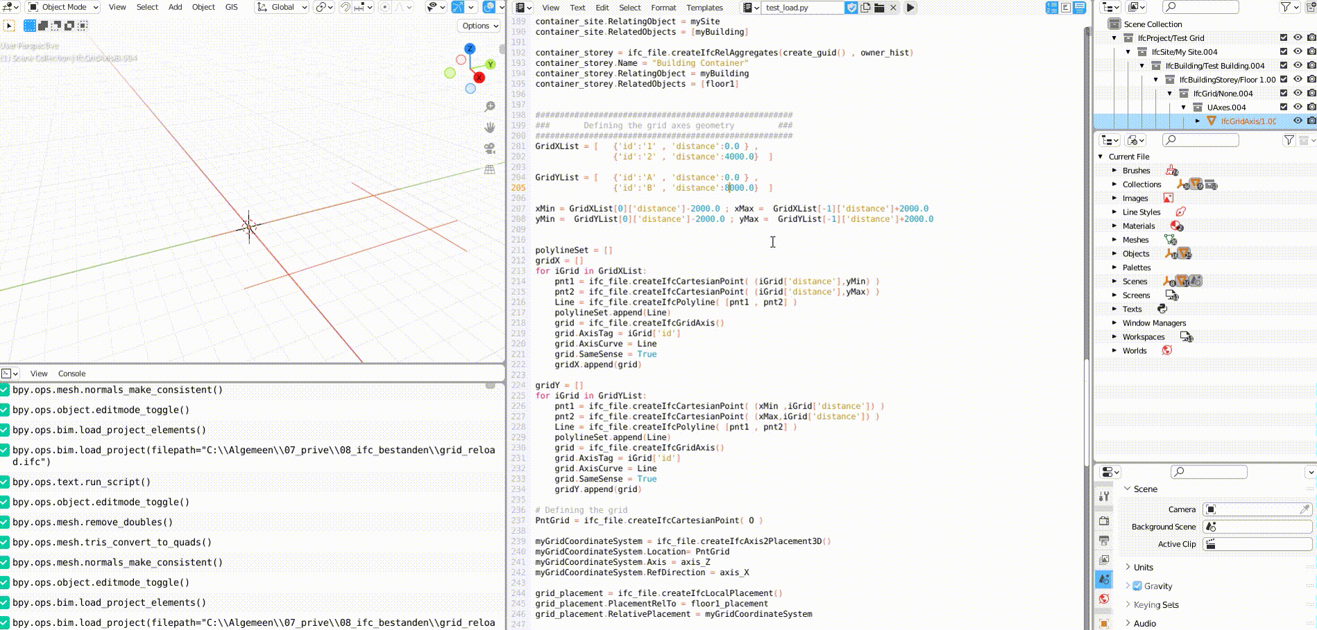
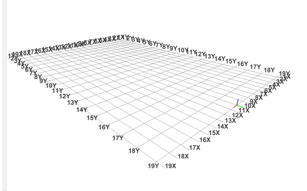
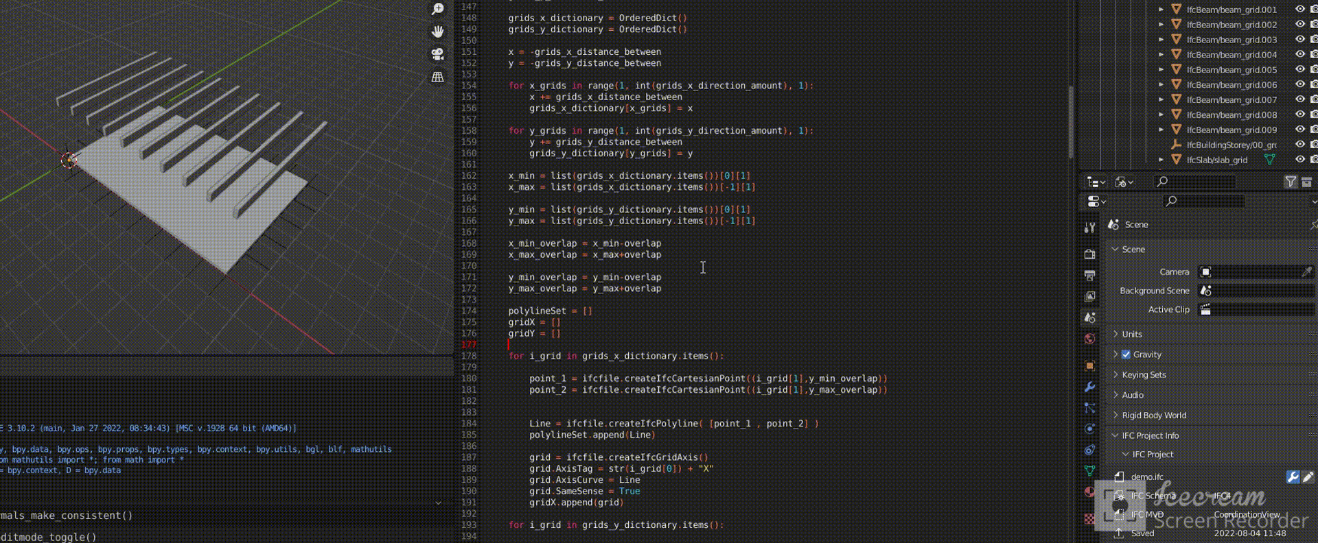
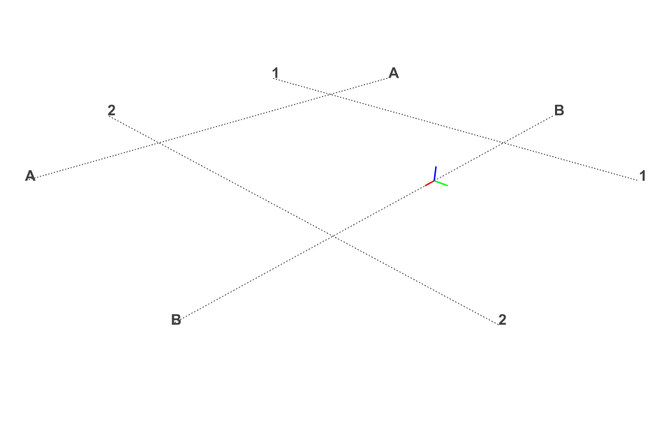
### Defining the grid axes geometry ###
#####################################################
GridXList = [ {'id':'1' , 'distance':0.0 } ,
{'id':'2' , 'distance':4000.0} ]
GridYList = [ {'id':'A' , 'distance':0.0 } ,
{'id':'B' , 'distance':4000.0} ]
xMin = GridXList[0]['distance']-2000.0 ; xMax = GridXList[-1]['distance']+2000.0
yMin = GridYList[0]['distance']-2000.0 ; yMax = GridYList[-1]['distance']+2000.0
polylineSet = []
gridX = []
for iGrid in GridXList:
pnt1 = ifc_file.createIfcCartesianPoint( (iGrid['distance'],yMin) )
pnt2 = ifc_file.createIfcCartesianPoint( (iGrid['distance'],yMax) )
Line = ifc_file.createIfcPolyline( [pnt1 , pnt2] )
polylineSet.append(Line)
grid = ifc_file.createIfcGridAxis()
grid.AxisTag = iGrid['id']
grid.AxisCurve = Line
grid.SameSense = True
gridX.append(grid)
gridY = []
for iGrid in GridYList:
pnt1 = ifc_file.createIfcCartesianPoint( (xMin ,iGrid['distance']) )
pnt2 = ifc_file.createIfcCartesianPoint( (xMax,iGrid['distance']) )
Line = ifc_file.createIfcPolyline( [pnt1 , pnt2] )
polylineSet.append(Line)
grid = ifc_file.createIfcGridAxis()
grid.AxisTag = iGrid['id']
grid.AxisCurve = Line
grid.SameSense = True
gridY.append(grid)
# Defining the grid
PntGrid = ifc_file.createIfcCartesianPoint( O )
myGridCoordinateSystem = ifc_file.createIfcAxis2Placement3D()
myGridCoordinateSystem.Location= PntGrid
myGridCoordinateSystem.Axis = axis_Z
myGridCoordinateSystem.RefDirection = axis_X
grid_placement = ifc_file.createIfcLocalPlacement()
grid_placement.PlacementRelTo = floor1_placement
grid_placement.RelativePlacement = myGridCoordinateSystem
grid_curvedSet = ifc_file.createIfcGeometricCurveSet(polylineSet)
gridShape_Reppresentation = ifc_file.createIfcShapeRepresentation()
gridShape_Reppresentation.ContextOfItems = footprint_context
gridShape_Reppresentation.RepresentationIdentifier = 'FootPrint'
gridShape_Reppresentation.RepresentationType = 'GeometricCurveSet'
gridShape_Reppresentation.Items = [grid_curvedSet]
grid_Reppresentation = ifc_file.createIfcProductDefinitionShape()
grid_Reppresentation.Representations = [gridShape_Reppresentation]
myGrid = ifc_file.createIfcGrid(create_guid() , owner_hist)
myGrid.ObjectPlacement = grid_placement
myGrid.Representation = grid_Reppresentation
myGrid.UAxes=gridX
myGrid.VAxes=gridY
# assignment to spatial structure ------------------------------------------
container_SpatialStructure= ifc_file.createIfcRelContainedInSpatialStructure(create_guid() , owner_hist)
container_SpatialStructure.Name='BuildingStoreyContainer'
container_SpatialStructure.Description = 'BuildingStoreyContainer for Elements'
container_SpatialStructure.RelatingStructure = floor1
container_SpatialStructure.RelatedElements = [myGrid]
file_path = "C:\\Algemeen\\07_prive\\08_ifc_bestanden\\"
file_ifc = file_path + file_name
print (file_ifc)
ifc_file.write(file_ifc)
</details>
How would I add the grid letter and number visibility in BlenderBIM? Like it is in BIMVision