M
by magicalcloud_75 on 25 Feb 2024, edited 8 Mar 2024
#
Hi guys. I'm trying to figure out this part.
Any ideas for a clearer picture? How does it work? The ultimate goal would be to make it part of the BlenderGIS addon as option.
Coming from this briljant recording on a older Blender release.
Thanks!
Hans
M
by magicalcloud_75 on 1 Mar 2024, edited 1 Mar 2024
#
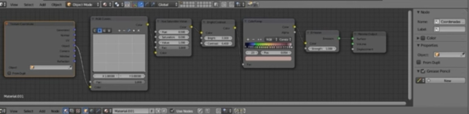
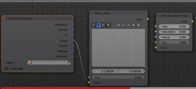
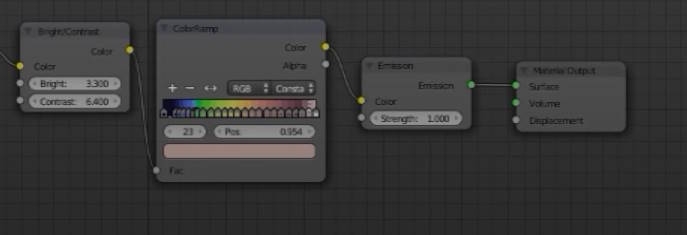
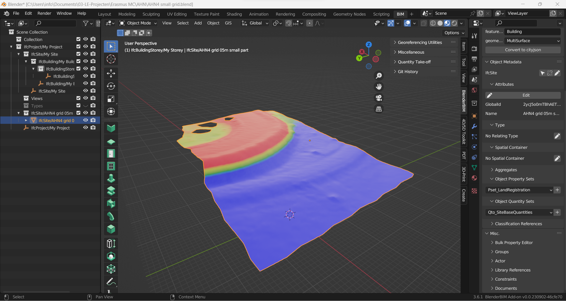
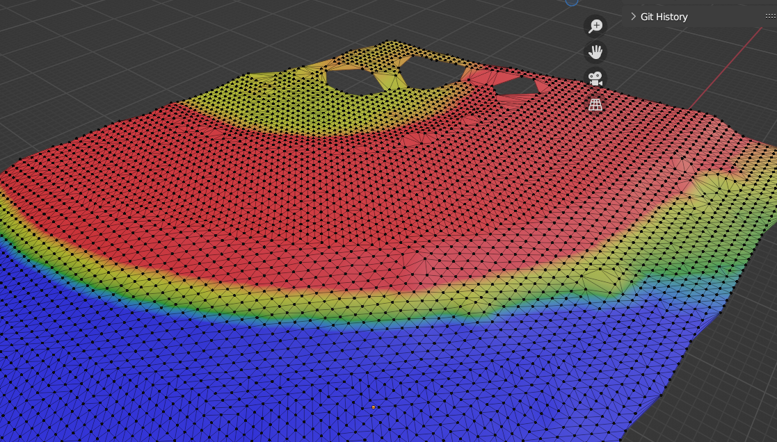
Managed to get clearer shots. So far, so good.
Added a IFC file to be tested
Texture coordinates > objects
RGB Curves > color
HueSaturation Value > Color
BrightContrast>Color
ColorRamp >Color
Emission
Material output, Surface
C
by camontellano on 1 Mar 2024
#
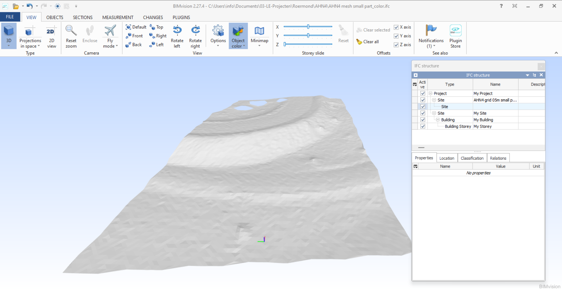
Hi...no colors are coming in. The Surface itself is being represented.
R
by RaphaëlVouilloz on 1 Mar 2024
#
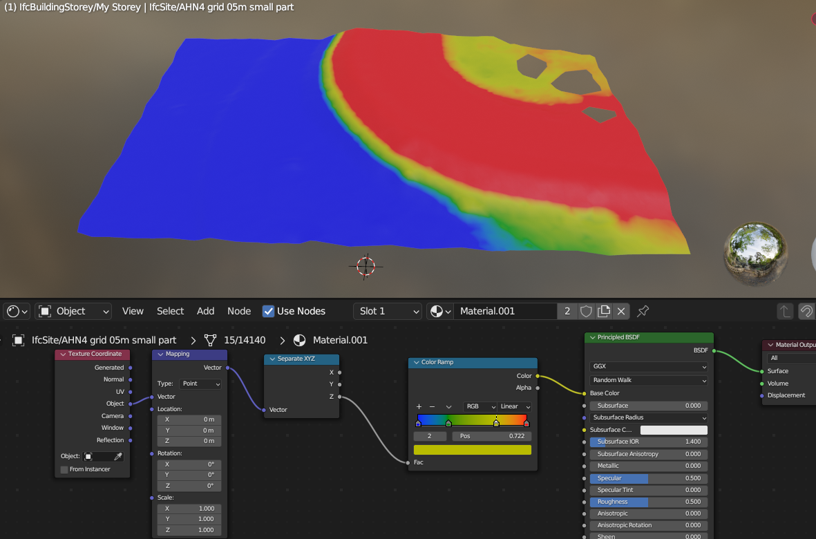
I would rather start from Generated in Texture Coordinate, plug the mapping vector in a separte XYZ node, then plug the Z value in the color ramp
M
by magicalcloud_75 on 1 Mar 2024, edited 1 Mar 2024
#
Do you have a file in which this is used? I want to learn this but it's not that easy to understand what you talk about.
I attached a IFC as sample. You would need to save it as Blenderfile
I managed to get this. But shading is not what IFC colors.
The saved view tool doesn't seem to work in the shading mode with geodata far off.
M
by magicalcloud_75 on 1 Mar 2024, edited 1 Mar 2024
#
How does one save shaded collored meshes to IFC?
R
by RaphaëlVouilloz on 4 Mar 2024
#
Sorry, I didn't understand that you wanted to save it in IFC. I don't know if you can save procedural textures
B
by bdamay on 4 Mar 2024
#
My opinion is that you cannot. AFAIK
M
by magicalcloud_75 on 4 Mar 2024
#
@"RaphaëlVouilloz" said:
Sorry, I didn't understand that you wanted to save it in IFC. I don't know if you can save procedural textures
Would be nice as visual technique. ifc site in grey is hard to see the diffrences in heights. Will try dwg.
G
by Gorgious on 7 Mar 2024, edited 8 Mar 2024
#
re https://community.osarch.org/discussion/441/mesh-color-to-ifc-export-in-blender and https://standards.buildingsmart.org/IFC/RELEASE/IFC4_1/FINAL/HTML/schema/ifcpresentationappearanceresource/lexical/ifcindexedcolourmap.htm You can either use vertex colors (I don't think it's implemented natively in BlenderBIM) or bake the colors to a texture map and link it as a style.
B
by bdamay on 7 Mar 2024, edited 7 Mar 2024
#
@Gorgious said: or bake the colors to a texture map and link it as a style.
Interesting - i didn't know about textures in ifc - i'll take a closer look
G
by Gorgious on 8 Mar 2024
#
AFAIK you can setup textures in IFC but the actual rendering depends on the software implementation, so YMMV.