Hi, i'm looking for a Blender way to model surfaces based on survey points. Points come from CloudCompare after saving to .ply. The [F] fill option does not work that well. I read about some potential (old) addons.
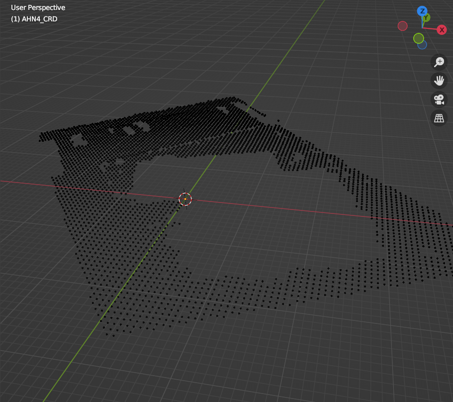
Hi, i'm looking for a Blender way to model surfaces based on survey points. Points come from CloudCompare after saving to .ply. The [F] fill option does not work that well. I read about some potential (old) addons.
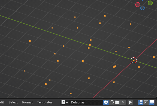
This is called Delaunay Triangulation. Here's a script I roughly adapted from a ChatGPT answer. I used it on a project last month. You'll need to install scipy.
import bpy

import bmesh

from scipy.spatial import Delaunay

import numpy as np


def delaunay():

    # Check if there is an active object and it's a mesh

    if bpy.context.active_object is not None and bpy.context.active_object.type == "MESH":

        # Get the active object

        obj = bpy.context.active_object


        # Get vertices from the currently selected mesh

        vertices = np.array([v.co for v in obj.data.vertices])


        # Create a new mesh and a new object

        mesh = bpy.data.meshes.new(name="DelaunayMesh")

        delaunay_obj = bpy.data.objects.new("DelaunayObj", mesh)


        # Add the object to the scene

        bpy.context.collection.objects.link(delaunay_obj)


        # Get a BMesh representation

        bm = bmesh.new()


        # Add vertices to BMesh

        for v in vertices:

            bm.verts.new(v)


        # Ensure the vertices table is populated

        bm.verts.ensure_lookup_table()


        tri = Delaunay([v[:2] for v in vertices])  # Use only x, y for triangulation


        # Create faces based on Delaunay triangulation

        for simplex in tri.simplices:

            bm.faces.new([bm.verts[i] for i in simplex])


        bm.to_mesh(mesh)

        bm.free()


        # Optional: Deselect the original object and select the new Delaunay mesh object

        bpy.ops.object.select_all(action="DESELECT")

        delaunay_obj.select_set(True)

        bpy.context.view_layer.objects.active = delaunay_obj


    else:

        print("No active mesh object selected.")


if __name__ == "__main__":

    delaunay()
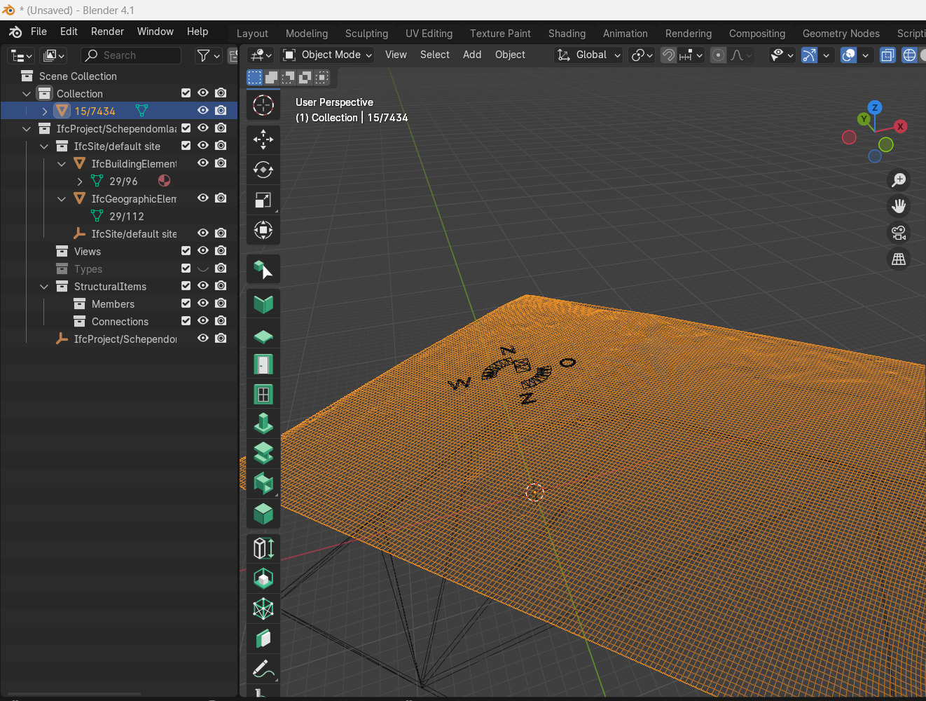
That works very nice. Thanks for this useful tip!
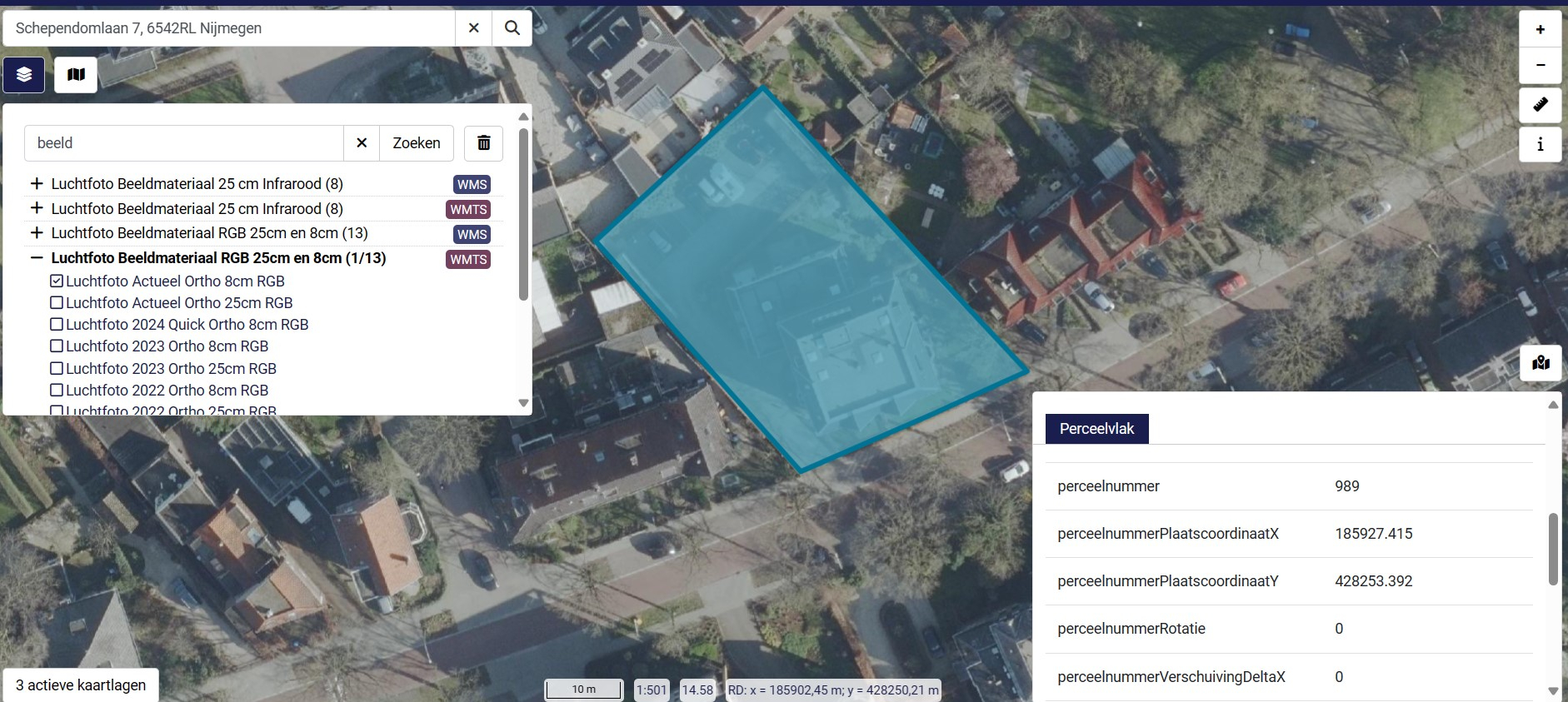
With quadremesh and saved as IFC. We are able to model plots nicely with dutch landregistry data (based on AHN).
The Delauny.py code does end with some error on my site. Regards
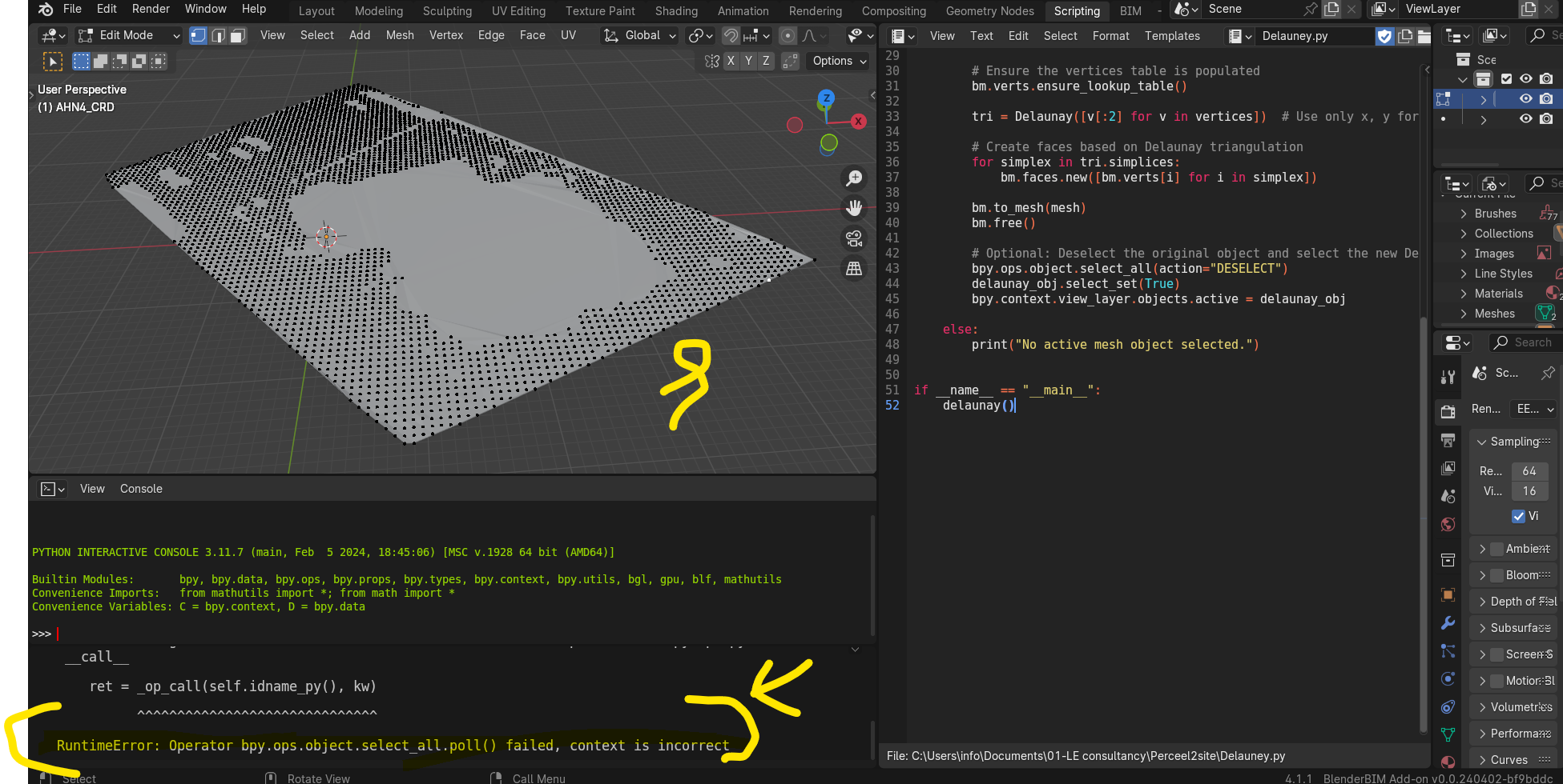
Yeah you can remove the 3 lines just after the # Optional comment line, they are superfluous and I think they're the culprit ones
Login or Register to reply.