A
by avico on 24 Jul 2024
#
+3 votes
@steverugi,
maybe this can help:
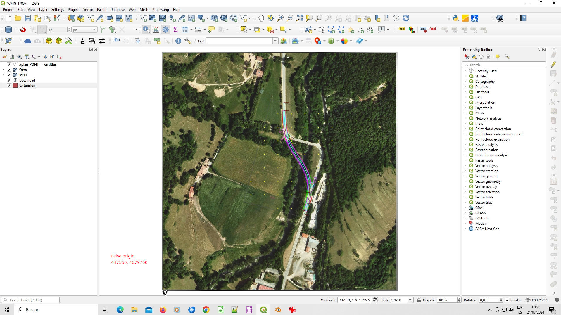
1.- Choose a point close to the project position as a "false origin" (in the image, false origin is the left bottom corner with coordinates value 447560, 4679700. In the qgis project are a raster file (MDT in *.asc format) and a jpeg image (Orto.jpg). Extract "Raster projection" with Raster->Projectios -> Extract projection).
2.- Open the model in real coordinates in BlenderBim using "enable advanced mode" and entering the XY coordinates as false origin in the import form (the point 0,0,0 is replaced by 447560, 4679700,0).
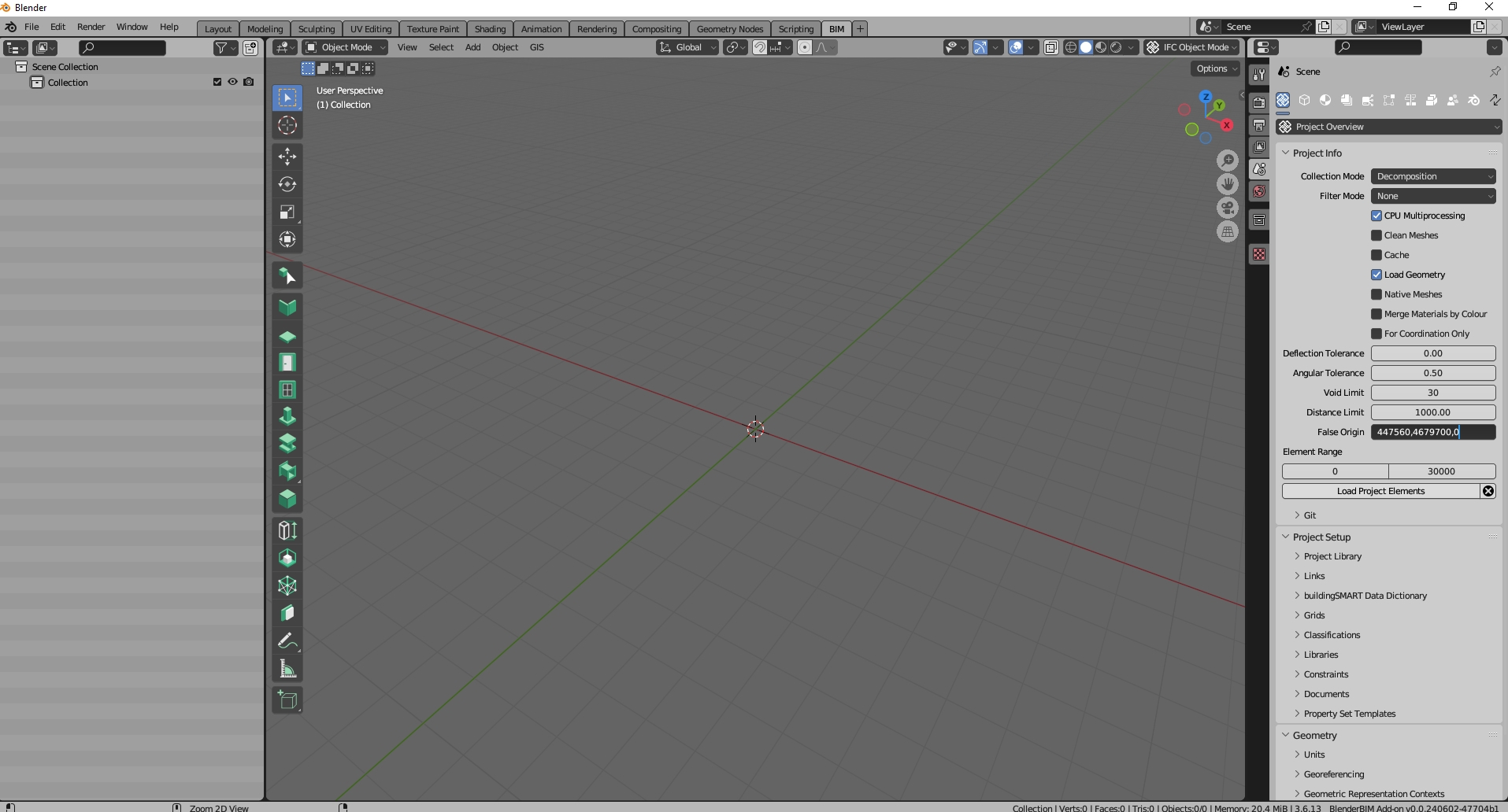
3.- In the Geoscene panel (n key -> View panel) choose the reference coordinate system and enter the init origin (+ button) with the 447560, 4679700 coordinates.
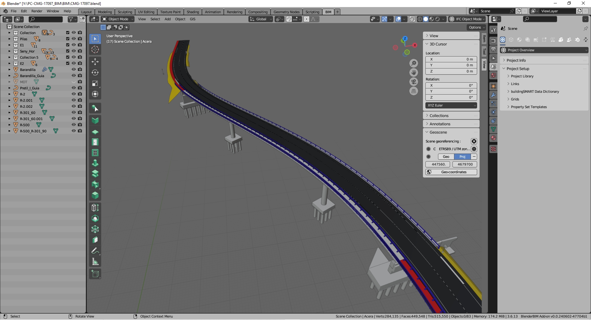
4.- Import the terrain (ascii file) with BlenderGis, entering the position data again. With this you have an object in Blender that is the terrain mesh in the correct relative position.
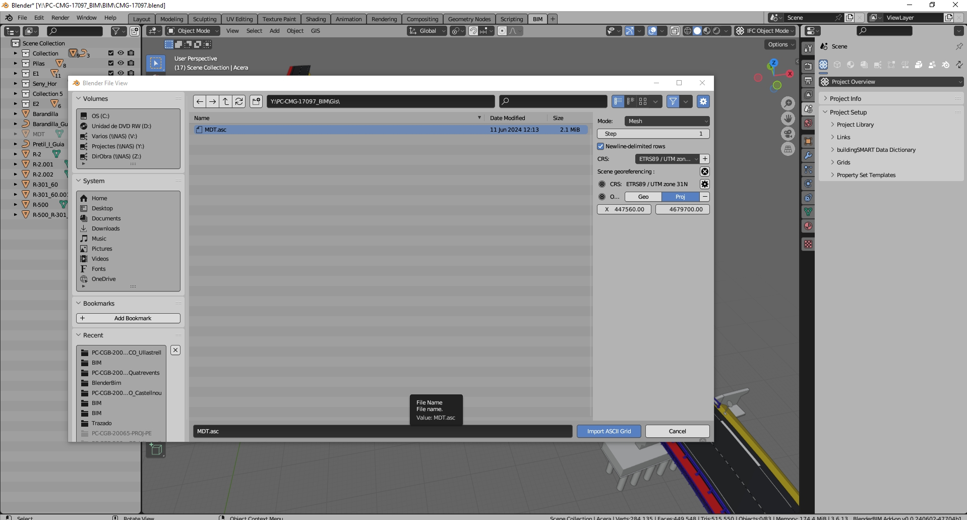
5.- Import the orthophoto with BlenderGis (again enter the position data) and choose to map it on the imported mesh.
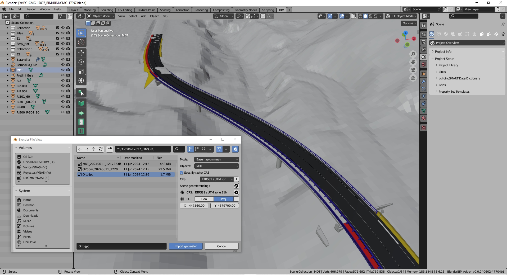
6.- Enjoy the result (look at previous images) ;-)
M
by Moult on 24 Jul 2024
#
The core issue is that BlenderGIS doesn't provide direct georeferencing beyond setting the origin of the geoscene. This means that while you can import GIS data and create a 3D model, the resulting data lacks the precise geographic coordinates necessary for IFC integration.
This doesn't seem right to me. IFC can set a false origin which is akin to "setting the origin of the geoscene" as well as the CRS, and therefore will be georeferenced.
S
by steverugi on 24 Jul 2024
#
massive thanks @avico
@steverugi,
maybe this can help:
it looks like you totally answered my request and in no time! most grateful for your help
A
by avico on 24 Jul 2024
#
Hi @steinryan28 ,
I don't understand the solution you propose as an alternative.
According to my experience, the objects imported with BlenderGis (the terrains that I have used so far) have a similar behavior to any other object imported into Blender (for example from Freecad) and their coordinates are correct with respect to the false origin defined. Their integration with Ifc is good and after adding them to the Ifc project (as a class IfcElemBuildingElementProxy for example) they work well. The project saved from BlenderBim in this way is correct and displays well from any viewer.
This is not georeferencing in IFC because the corresponding information is not defined, but the position of the objects is correct (with respect to the false origin chosen). To obtain the real coordinates just use IfcPatch as explained above.
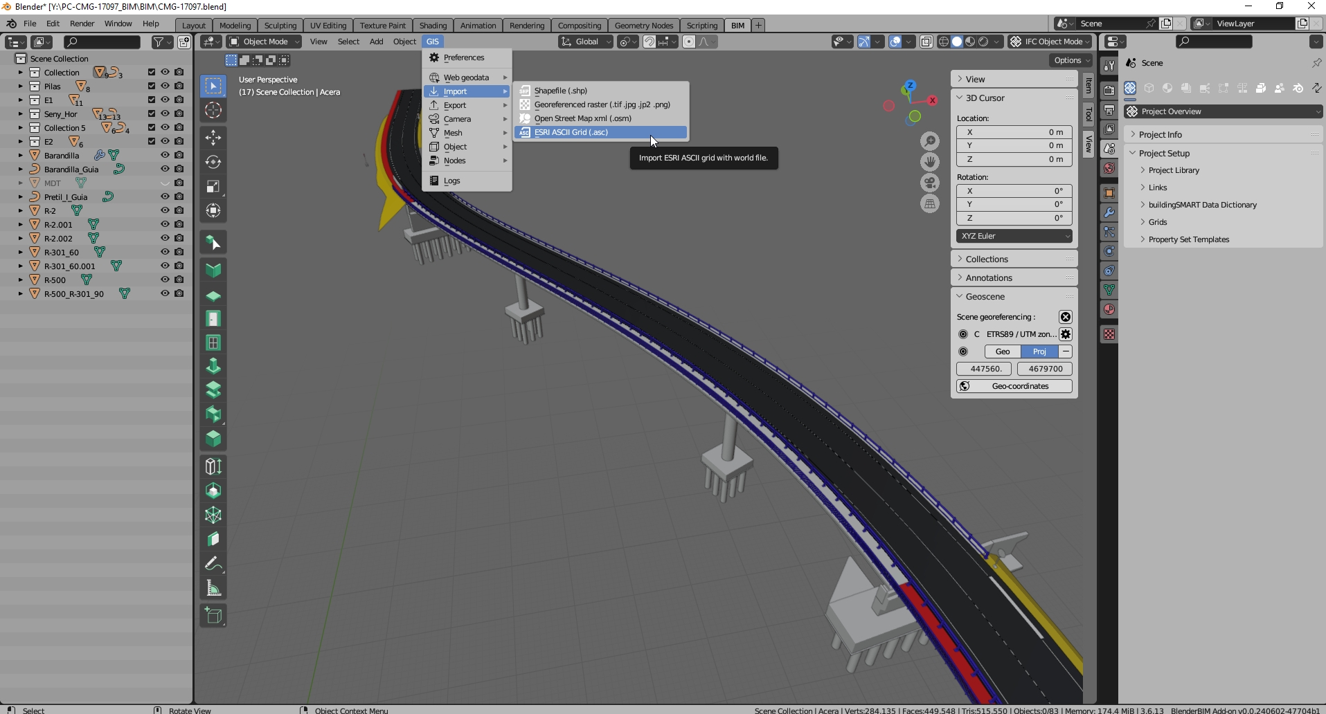
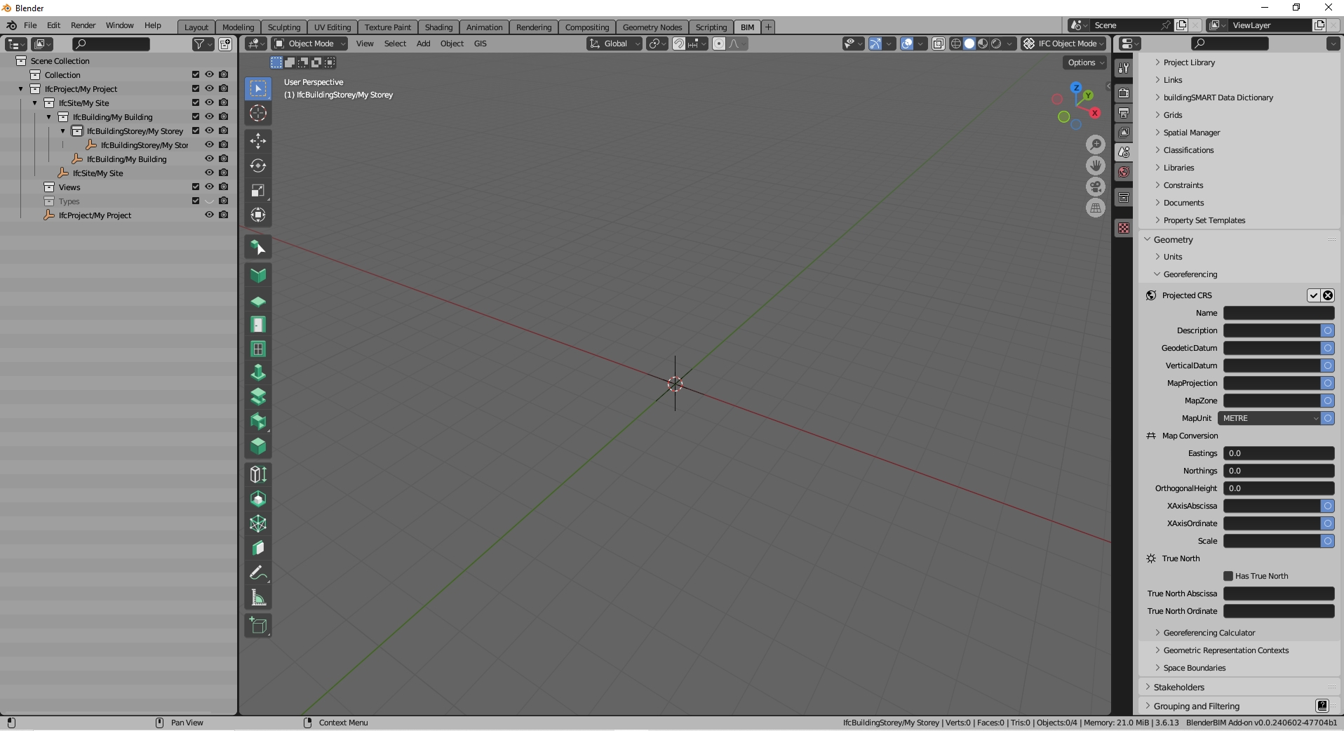
I normally have to use IFC2x3 and it lacks information to georeference the project, but the models obtained have the correct coordinates even though information about the coordinate reference system used is not included. With IFC4 this information can be included and BlenderBim already incorporates it (see image).
M
by Moult on 24 Jul 2024
#
+1 votes
To obtain the real coordinates just use IfcPatch as explained above.
Just to help reword this with more specific terminology, the IfcPatch suggestion merely means to make local engineering coordinates fully equivalent to map coordinates with no false origin, no project north, and no scale factor. Assuming a CRS is nominated, both options of using a false origin or having local coordinates directly in map coordinates are georeferenced correctly in the same spot from an IFC perspective.
I normally have to use IFC2x3 and it lacks information to georeference the project
Fun fact: the BlenderBIM Add-on supports the IFC2X3 fallback georeferencing method. And this integration has been made even more complete in the latest alpha builds. Just select your IFC project then add the georeferencing psets to them.
A
by aogino on 29 Jul 2024
#
+2 votes
@aogino said:
I may have come to the conclusion that maybe my issue is not related to the georeferencing from local to projected coordinates that I do using IfcPatch. It's probably the GIS data that has heterogeneous coordinate systems and when combined and converted to 3D using BlenderGIS, there are a lot of distorsions. I checked horizontal distances between specific buildings in my .ifc and compared them with the same distances in a gis software (like QGIS) and there is a big offset.
Conclusion: Beware of 3D objects generated using BlenderGIS, we might need some expertise from people that have experience with it, for now the lead developper is not very responsive ...
I found the issue, it lies within the basemap generation tool of BlenderGIS. It is hardcoded to web-mercator, and you'll need gdal installed to do the reprojection (I did the test and it failed, this error occurred : https://github.com/domlysz/BlenderGIS/issues/702). Since the basemap in in web-mercator, the terrain will also inherit that crs. That is what explains the offsets in (X,Y) coordinates after georeferencing using IfcPatch.