M
by magicalcloud_75 on 21 Dec 2020, edited 6 Dec 2021
#
Converion time.. :)
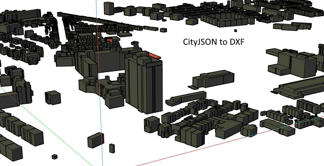
I have CityJSON converted to (DXF) coming from FME
Tried FBX, IFC2x3 and IFC4, nothing comes to display in Blender.
Anyone have an idea why none iof thes imports seem to work?
Also, the default DXF show no objects
FBX?
IFC? sites?
S
by stephen_l on 21 Dec 2020
#
Either a georeference so objects are miles away from scene center, or a scale issue or a view near / far clip issue.
S
by stephen_l on 21 Dec 2020
#
Also pay attention at coordinate system (projection) or you may face with up to several meter offset / deformations.
M
by magicalcloud_75 on 21 Dec 2020, edited 21 Dec 2020
#
I uploaded a DXF [m] with the CityJSON file to this drive.
The json file is about 50 MB. We (in NL) have a serious hurdle to take work with json GIS as open format to use in 'bim'.
I see very limited possibilities to convert it to something 3D worakble. Only one 'commercial workflow '
Should be a smooth ifc json brigde if you aks me, Thanks for tips & advice. Maybe you can take a look
https://drive.google.com/drive/folders/1fp3KCp3oPqykUqSWmQBsWF-g39gywJGH?usp=sharing
M
by magicalcloud_75 on 21 Dec 2020
#
The CAD drawing
https://drive.google.com/file/d/128OQ7CI2yLbYIoc-Mt0NBhcaK8AGL6M0/view?usp=sharing
In DWG this kind of work is slow as hell. Blender speed needed badly :)
M
by magicalcloud_75 on 26 Dec 2020, edited 26 Dec 2020
#
My conclusion is that sofar only one commercial software able to work with CityJSON files is FME. I asked someone to translate it to DXF so i can work with it.
Maybe other countries have other more accessable formats or datasets. In the Netherlands CityJSON was the choice so we have to deal with that. As community we could make it part of a combined effort to convert this kind of gis geometry into other suitable 3D formats to work with.
News!
https://www.ogc.org/pressroom/pressreleases/4376
and as part of a challenge
https://community.osarch.org/discussion/comment/4761/#Comment_4761
M
by Moult on 27 Dec 2020
#
CityJSON looks pretty straightforward to support. We can probably hack together an importer in a day. Unfortunately right now it's a little down in the priority list.
M
by magicalcloud_75 on 27 Dec 2020
#
I just came across this. Some work has been done. Great stuff
https://github.com/cityjson/Up3date
M
by magicalcloud_75 on 1 Jan 2021
#
+3 votes
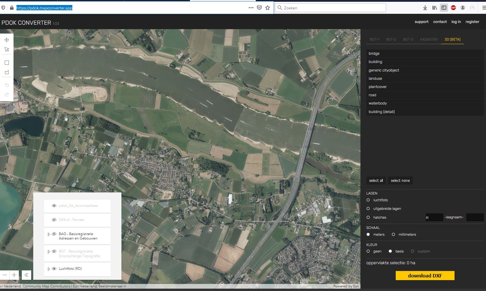
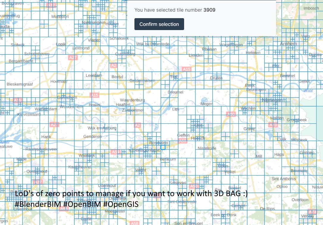
https://pdok.mapconverter.app/
M
by magicalcloud_75 on 2 Jan 2021, edited 2 Jan 2021
#
+1 votes
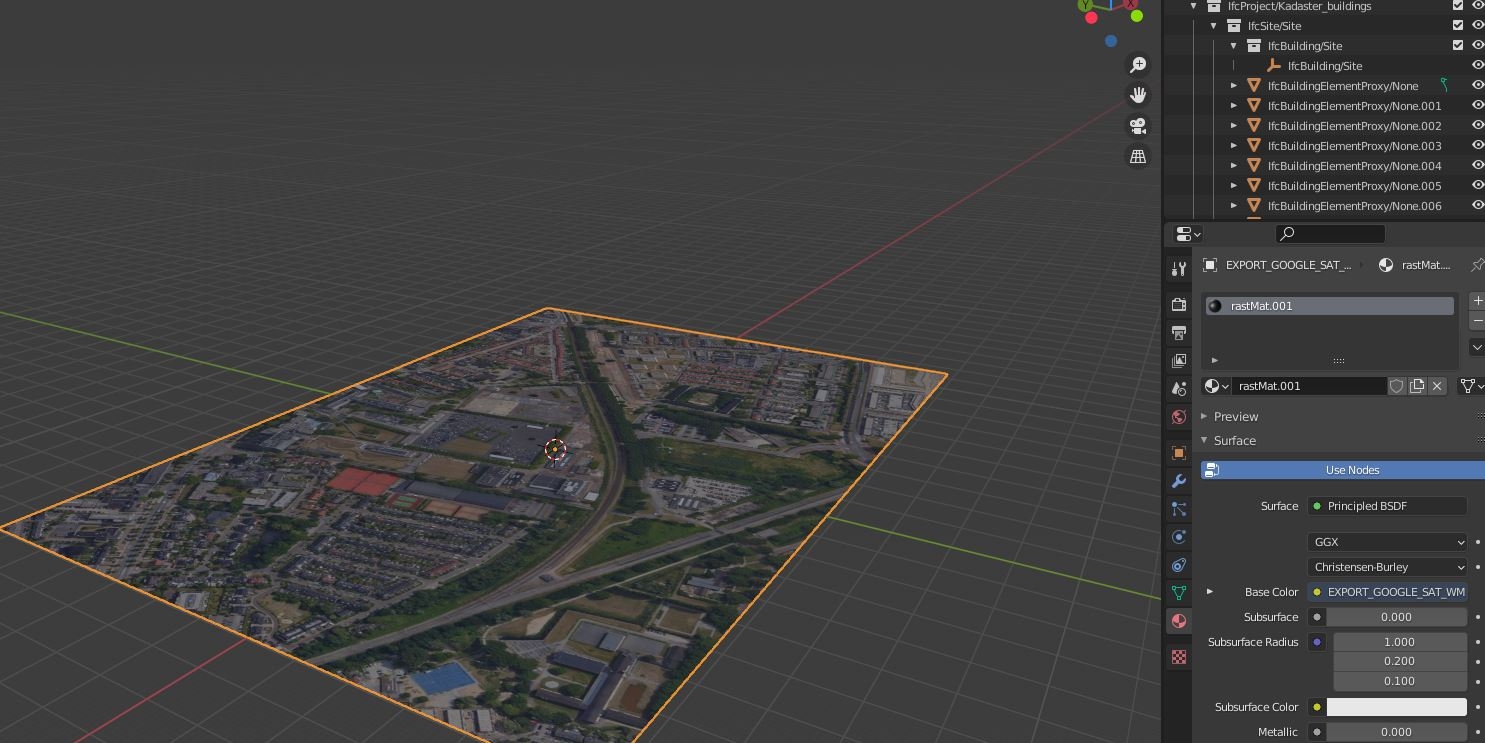
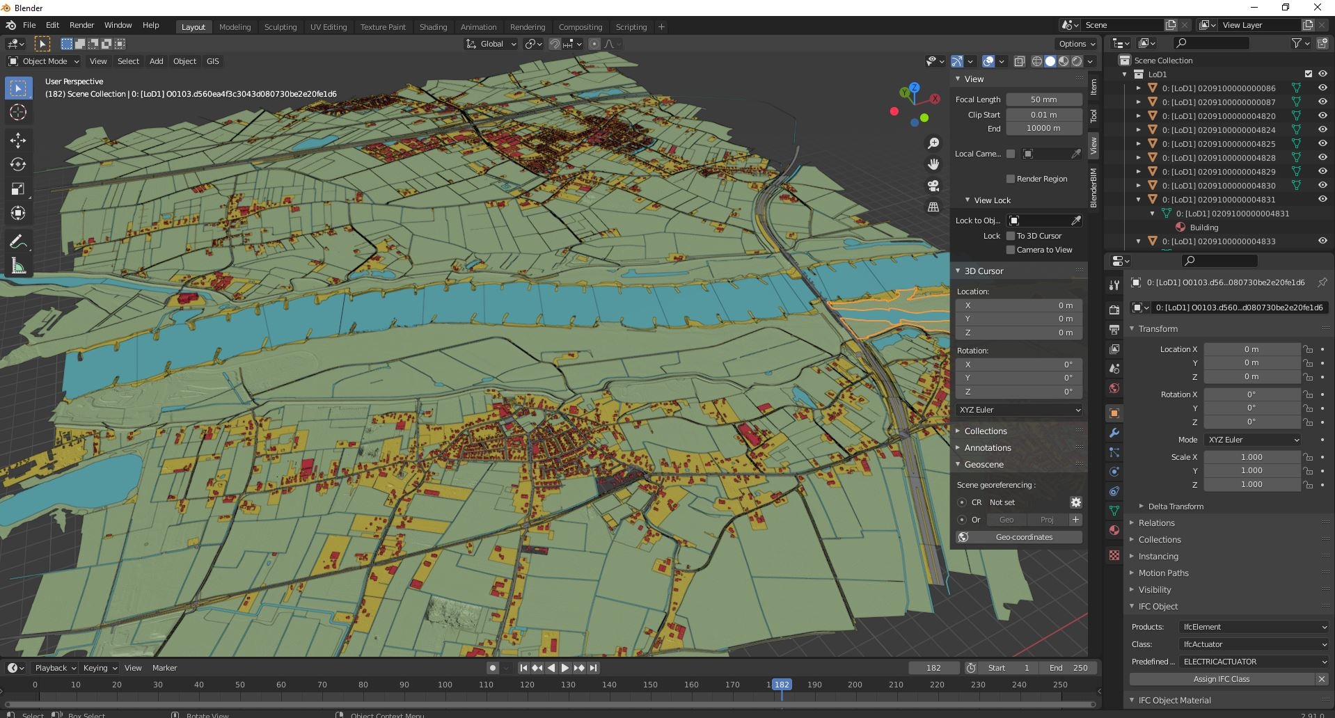
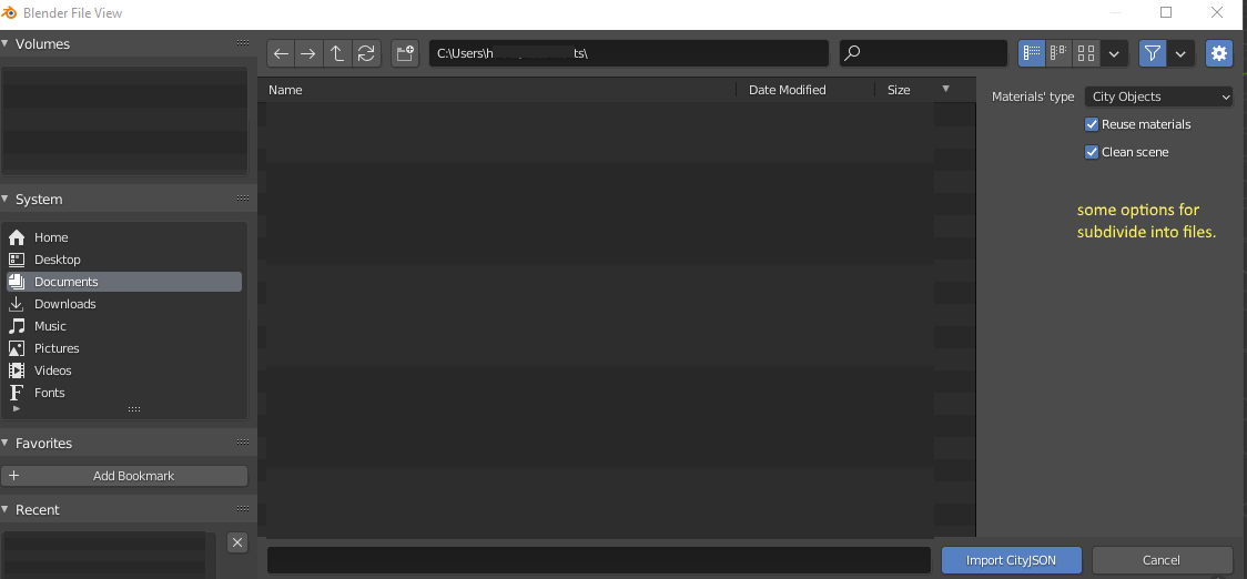
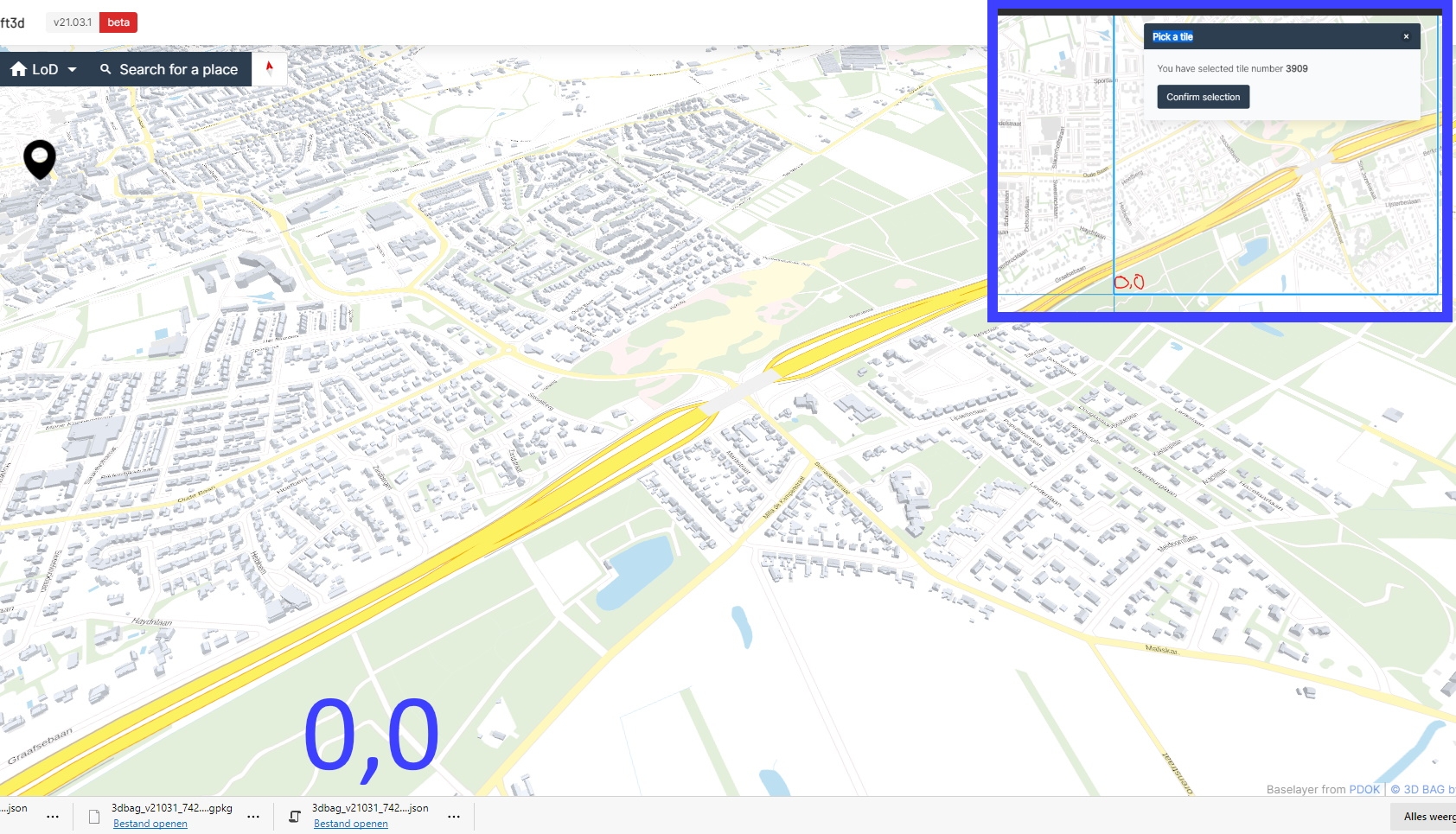
The targeted DXF download fills a real need for most CAD/GIS closed AEC software for the Netherlands. More cities will be added later. The other route, using Blender, is a big area download file of about 200-700 mb json file that leads to about 2.6 GB blend file (second screenshot) . I was able to get a view (15000 m field view)but only the option 'building objects' on import allows a zoom to object (?)
My question now is this. What is a normal filesize for Blender to work smooth? I was thinking the power of blender maybe able to crack this import further. So, what tools or script do we have to make this more compact and usable as groundmap? Clipping, deleting metadata, remeshing, etc.
Thanks!
Original downloads for cityjson NL
https://3d.kadaster.nl/basisvoorziening-3d/
M
by magicalcloud_75 on 7 Jan 2021
#
OGC seeks public comment on new CityJSON Community Standard
https://www.ogc.org/pressroom/pressreleases/4381?utm_content=buffer4f60a&utm_medium=social&utm_source=twitter.com&utm_campaign=buffer
Big challenge i experience is the filesize it brings. The dutch government makes it way to big.
M
by Moult on 7 Jan 2021
#
@magicalcloud_75 I was under the impression that it was an alternative syntax to CityGML. Given that CityGML is XML and this is JSON, JSON should be a smaller filesize than the equivalent data in XML.
M
by magicalcloud_75 on 8 Jan 2021, edited 8 Jan 2021
#
https://www.mdpi.com/2220-9964/9/9/502
Yes that's correct. So if it is converted 600 mb dutch Kadaster files turn into 2.5 Gb blender file. These cityjson shouldn't be more than say 50 mb to be able to work with?
S
by stephen_l on 8 Jan 2021
#
Blender is able to manage such huge datasets by linking files instead of actually append objects right in the scene. As long as snap to Kadaster is not required, may be an option.
M
by magicalcloud_75 on 8 Jan 2021
#
Segregate different mesh / building elements into different files would be a good idea. How does one do this efficient after importing and habing a 3 GB? Some smart script that can split it up into parts/area's? I was looking for a way select meshes with a specific color. Than copy paste them in a seperate file. These kind of things can bring me further. thx
M
by magicalcloud_75 on 29 Mar 2021
#
+2 votes
Hi
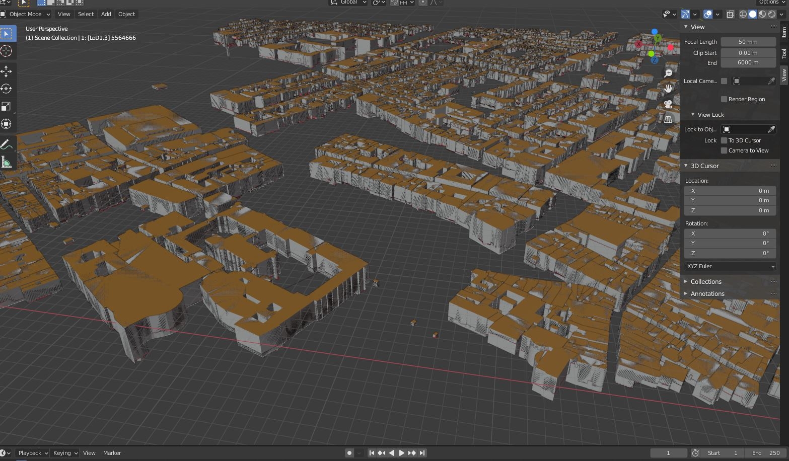
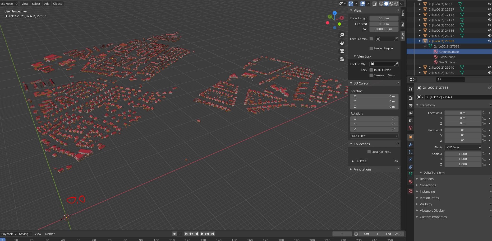
Just downloaded and imported a tile from https://3dbag.nl/en/viewer using cityjson.. again ..:P
2 questions pop up.
-
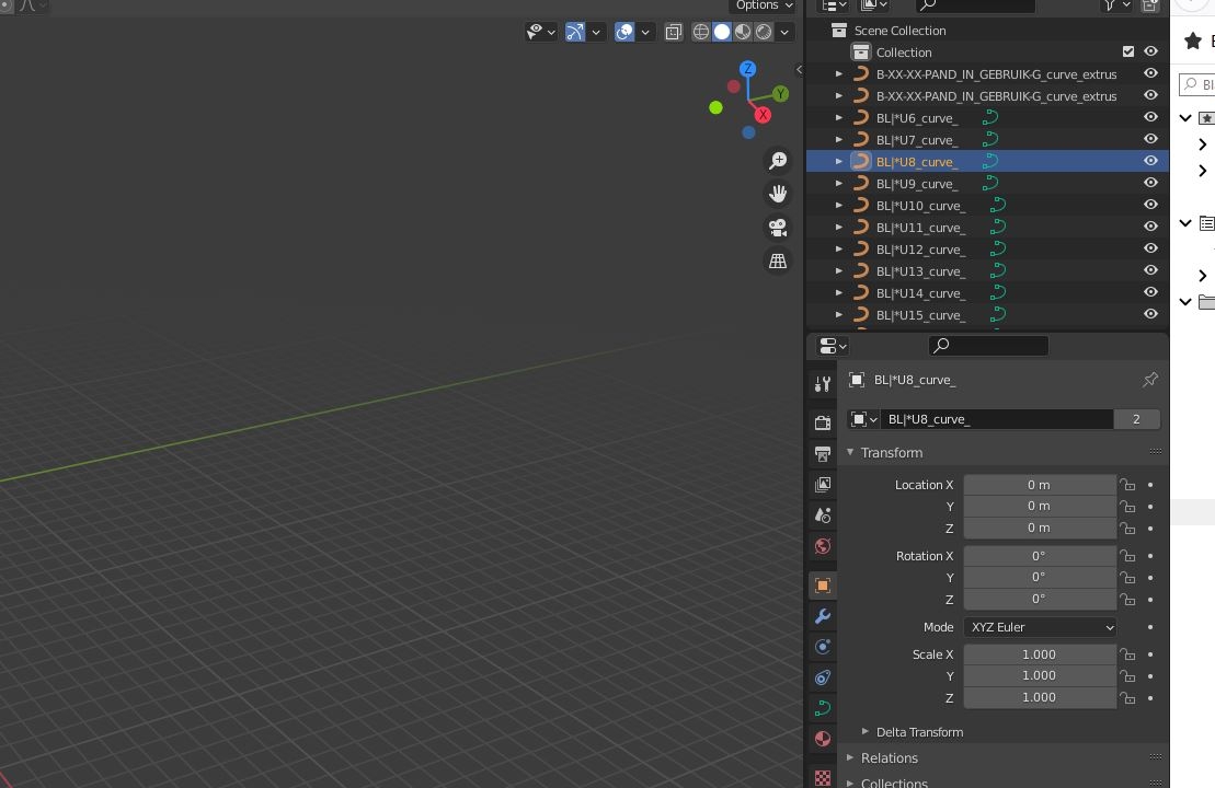
Why does Blender display it this way? Seem to mix up LOD's so..
-
How do i filter and erase all LOD1.1 and LOD1.2? (i just want to keep LOD2.2
M
by Meetlat on 30 Mar 2021, edited 30 Mar 2021
#
Bedankt @magicalcloud_75 ! Goede vondst, dit is geweldig!
Alternative you can download the zip with OBJ files in de tile picker. Each LOD version is a separate file.
L
by LaurensJN on 30 Mar 2021, edited 30 Mar 2021
#
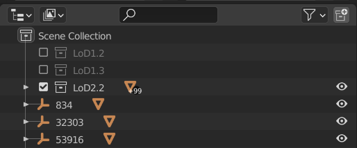
This is awesome! If you import the cityJSON in Blender (with the Up3date add-on), the LoDs are in different collections. If you go to the outline tab, you can just turn the other LoDs off:
D
by duncan on 30 Mar 2021
#
@Meetlat @LaurensJN @magicalcloud_75 please make a social media post about why this is all so cool so I can promote it. Link here or here: https://community.osarch.org/discussion/376/social-media-posts-to-spread#latest
M
by Meetlat on 30 Mar 2021, edited 30 Mar 2021
#
+1 votes
@Duncan see https://3d.bk.tudelft.nl/news/2021/03/26/release-3dbag.html for the announcement article. You could repost that on the OSArch blog. It's cool because now we have a 3d model of all the buildings of the Netherlands with a higher LOD than before. Including the roof pitch! Before it was a simple extrusion of the building footprint.
I made a social media post here: https://www.linkedin.com/feed/update/urn:li:activity:6782693573851668480/
M
by magicalcloud_75 on 30 Mar 2021, edited 30 Mar 2021
#
+1 votes
Yes, this will get attention. Open BIM and Open GIS coming together, thanks to this nice effort.
Geopositioning- wise the datasets need some more attention. I didn't check BlenderGIS.
But each subsets of 3DBAG NL seem to be defined in a local origin. Exportting meshes to DXF , these can only be used if the raster used in 3DBAG is known and shared. What i think. Maybe BlenderGIS might take 3DBAG data to the next level. (?)
D
by duncan on 30 Mar 2021
#
@Meetlat said:
I made a social media post here: https://www.linkedin.com/feed/update/urn:li:activity:6782693573851668480/
Sorry, don't speak Dutch (assuming it's not Flemish)
L
by LaurensJN on 31 Mar 2021
#
+1 votes
It's created by the 3D geoinformation group of TU Delft. This is an (English) post from the professor 3D Geoinformation Jantien Stoter about it:
https://www.linkedin.com/posts/jantien-stoter-7721346_3dbag-activity-6782213871764684800-fVR9
M
by magicalcloud_75 on 31 Mar 2021, edited 31 Mar 2021
#
+1 votes
"
How did I do this? This was a 3 step process: 1) Download the 3D Buildings in CityJSON from this website: https://3dbag.nl 2) The CityJSON files shared by TU Delft can be easily consumed in ArcGIS Pro by using Quick Import (based on Safe Software’s FME) and then shared as OGC i3s 3D Object Scene Layers. 3) Add the 3D Buildings to a web scene and start adding more layers like basemaps, elevation, trees and others to complete your digital twin.
" academics say
Hanging around here to find other ways and possibilities :)