I see that building smart has a call for standards development around IFC Site Landscape and Urban Planning. I reached out to them a year ago and never heard anything back. The timeline for completion has passed. Has anyone heard any updates on this front?
I hate to say it, but a lot of inquires (solicited, or otherwise) go unanswered from BuildingSmart.
Imo BS is looking to far ahead, not really a source for pratical questions and answers.
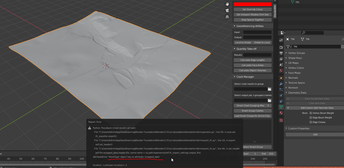
My Hands-on question is this .. how can i trun my TIN from Qgis / 3D .SHP into a DTM landscape terrain that is suited to fit IFC schema?
I would really love push this foward into eg. Autodesk Revit as an alternative to (Civil3d) Autodesk dwg as workflow. :P
@theoryshaw said:
I hate to say it, but a lot of inquires (solicited, or otherwise) go unanswered from BuildingSmart.
Unfortunately, this is true. That said, we can only try: https://forums.buildingsmart.org/t/progress-update-on-site-landscape-and-urban-planning/3617
I would like to help buildingSMART organise a structured and transparent workflow for community-driven (i.e. by user usecases, or by implementer technical reasons) changes to be received, reviewed, and implemented. Currently, they do not seem to have this transparent process, and changes in the spec seemingly pop out of nowhere and many errors persist.
This looks like an interesting comparison between some different standards. https://buildingsmart-1xbd3ajdayi.netdna-ssl.com/wp-content/uploads/2021/02/IDBE_Standards_Integration_v1.1_28_JAN_2021.pdf
Hi mutual intrested people
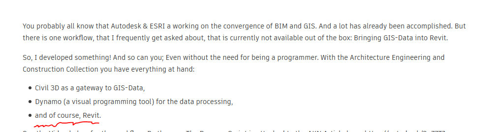
This is a fresh new and interessting video of what's cooking in the ESRI Autodesk kitchens. I see IFC there.
but
Why is Revit & GIS.. so .. of course? They are really totally two different animals and i think IFC is far from ideal and ready.
Does Autodesk develop IFC 4 landscape / infra further or is is a 'teaser' /puller ?
2
I believe infra, road, rail stuff is coming pretty soon into IFC, so certainly this overlaps with GIS. There is work underway in IfcOpenShell to support all the new rail stuff including some fancy maths that goes completely over my head.
Hopefully landscape and environment will come next.
Just dropping in here.
Working on my routines to further utilize the use of DXF and PNG in Qgis. (overlayed, transparency, CRD with world files etc.)
Lots of great posibilities coming form QGIS for construction industry and AEC (still hate the word to box me in...)
Until that day 3D IFC software has significance to offer i will continue a focus on 2D when it comes it.
@Moult 'Pretty soon' ? i hope you don't mind i translate this from BS terms as '.. some years from now'
Hope it proves me otherwise though :P
@magicalcloud_75 my definition of pretty soon is that IfcOpenShell already has rudimentary support for various new infra geometry, and it has recently been added to my todo list to allow users to start testing this via the BlenderBIM Add-on UI. So in my opinion that is within months, a user can start seeing multiple real implementations. There is also an open source infra IFC viewer already available.
Paper on creating vegetation in IFC and BIM
https://www.researchgate.net/publication/355135381_IFC-CENTRIC_VEGETATION_MODELLING_FOR_BIM
And on Landscape Information Modeling (LIM)
@magicalcloud_75 said:
Hi mutual intrested people
Why is Revit & GIS.. so .. of course? They are really totally two different animals and i think IFC is far from ideal and ready.
Well to me it reads mor like " of course even after 20 years of development revit is stil incapable of such fundamental tasks out of the box, so I'll show you how you can program this yourself"
But maybe it's just me.